

Palmist Ankur is a leading mundane astrologer based in Norway. He has numerous successful earthquake predictions to his credit, including the Kamchatka mega quake, the December 8 Japan M7.6 quake, and the highly damaging Bangladesh, Bohol (Philippines), Afghanistan, Mandalay and Shigatse earthquakes in the recent past. He has also accurately predicted several tech outages, disasters and accidents (Hong Kong, Dhaka and Ōita fires, UPS plane crash in Kentucky, Bali bus accident, Amur Oblast plane crash, Bangladesh plane crash, etc.), as well as weather events. All his astrological services can be viewed here.
How to read the earthquake predictions: I give precise areas or precise “lines” around which the earthquakes may take place during a given period of time (9 to 11 days): thus, if a line is crossing three countries, I am not giving such a loose prediction as that the earthquake may happen anywhere in those three countries. Rather, I am predicting that the earthquake would happen close to this line (within 250 km, but often much closer). This technique can, of course, be refined further, so as to obtain reliably the latitude on the line where this quake would take place: I do succeed sometimes in also judging the latitude, but to do it on a consistent basis requires more research and resources. Currently, my foremost interest is establishing correlation between astrological charts (planetary positions and movements) and real events of earthquakes and thus demolishing the myth held by modern scientists that earthquakes cannot be predicted.
Please read this sticky post to understand better the advantages and shortcomings of my earthquake prediction techniques as of now.
And please do support me in this endeavour by following my work, by telling others (including journalists) about my work, and also through donations, if you can afford it.
If you want me to provide earthquake predictions’ probability for a specific location during a specific period in the future, it is a paid service. Please see here (limited scope, nominal charge) or here (larger scope, higher charges).
To see a non-exhaustive list of successful Weather & Earthquake Watch predictions in the past, click here (for 2024) or here (for 2025). I update that list only sporadically for lack of time, given that each day will bring several successful predictions. More frequent updates regarding successful predictions can be found on my social media.
STANDING WARNING by me since a long time:
“Overall, there could be several huge or damaging earthquakes and landslides as well as water-related events (tsunami, severe typhoons, floodings, etc.) in the world during the period from late July 2025 to April 2026.”
Other points to remember:
(1) I had tweeted this on 1 December: "The period from 7 to 11 December 2025 may again be marked by heavy rain and floods, strong accidents, violent incidents (esp. in edu institution), noteworthy earthquakes and some kind of a tech outage or cyber breach (or major network failure of any kind: telecom, power, etc.)." Given that the dates 10-11 December 2025 are yet to come, also read prediction lines given in the 3-13 December 2025 post. See here (for Eastern Hemisphere) and here (for Western Hemisphere).
(2) On 19 November, I had also tweeted that "Dec 14-15 increase further the possibility of storms, terror, violence." Keep this in mind.
(3) 20-21 December may produce strong rain in some places, and incidents of terror are also possible. Aviation incidents or troubles also possible. There may be difficult incidents involving Muslim lands or communities.
(4) There is a high possibility of a major transportation accident, probably air crash, during 10-21 December.
Some of the potential areas in the Western Hemisphere are as follows:
Kentucky-Missouri wider area (USA), California area (USA), Alaska area (USA).
(5) Overall, the period of 10-21 December may bring very violent accidents and incidents (including possibly terror attacks) and heavy conflicts. It could also bring death/sickness of some prominent leader(s) or business magnate(s).
(6) A few critical dates and rough timings are as follows within this period:
10 Dec 2025, 4:00 AM UTC
12 Dec 2025, 6:50 AM UTC, 11 AM UTC
13 Dec 2025, 1:15 AM UTC
17 Dec 2025, 12:15 PM UTC
19 Dec 2025, 7:30 PM UTC, 11:45 PM UTC
20 Dec 2025, 10 AM UTC
The likelihood of the occurrence of any major malefic event increases within a few hours of the above times. Those written in bold font appear further malefic.
And now below is the next set of predictions, for the Western Hemisphere. Predictions for the Eastern Hemisphere (i.e., Part I) were published here earlier.
Astroseismological predictions for the period from 10 to 21 December 2025 (Part II, Western Hemisphere):
This post won’t be edited once published. This post is being published on 9 December 2025 UTC 22:59. If any typos are discovered later, they will be left as is. If any more serious errors are discovered or something missing is found later, they would be published in a separate Errata/Addendum post.
Earthquakes are predicted near the following imaginary lines. You may extrapolate all lines further at both their ends (especially for accidents). Ignore red coordinate symbols: they usually don’t mean anything special other than they are also a point on the respective line.
- Straight line running through 42°00′N, 3°45′W (near Lerma, Castile and León, Spain). There may also be prominent malicious activity or crime incidents near this line during this period. Thunderstorms possible at some places near this line. One should note that the line passes right through Madrid, the capital of Spain.
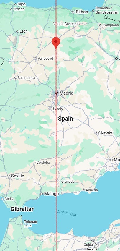
Given its malefic nature, one should also look at a wider overview of the line:

- Line between 32°00′N, 12°00′W (off Essaouira, Marrakesh-Safi, Morocco) and 6°00′N, 1°27′W (near Obuasi, Ashanti Region, Ghana).

- Line between 42°00′N, 19°03′W (off Portugal) and 32°00′N, 13°08′W (off Morocco). There may also be accidents and other malefic incidents near this line. Strong winds or heavy lightning could take place near some parts of this line. There may also be changes at the top in some places near this line.
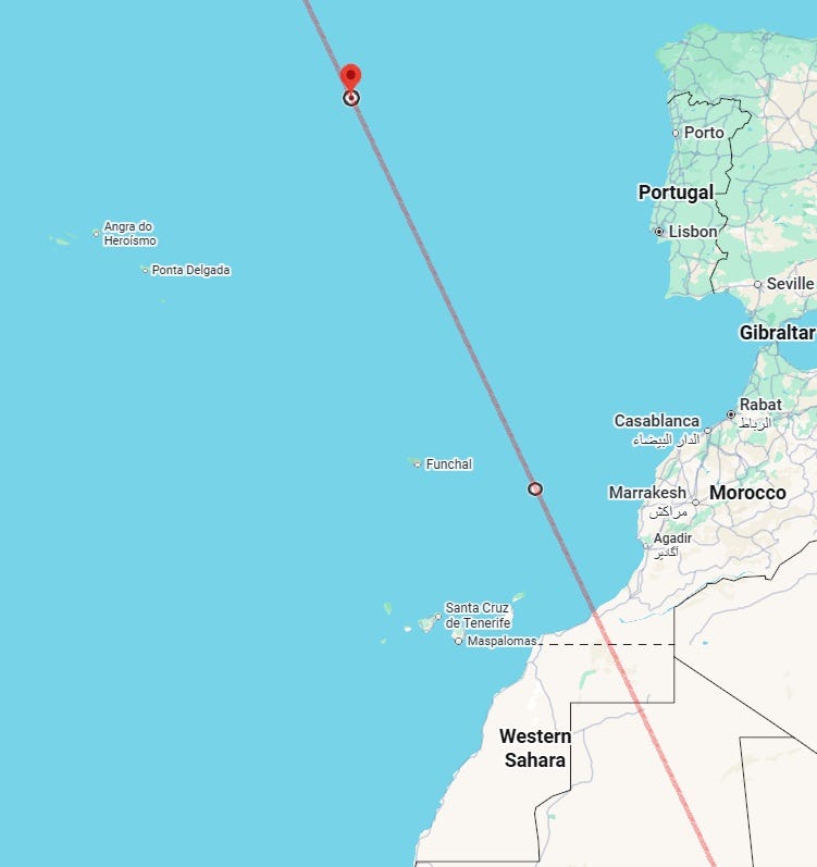
A wider overview of the line is thus:
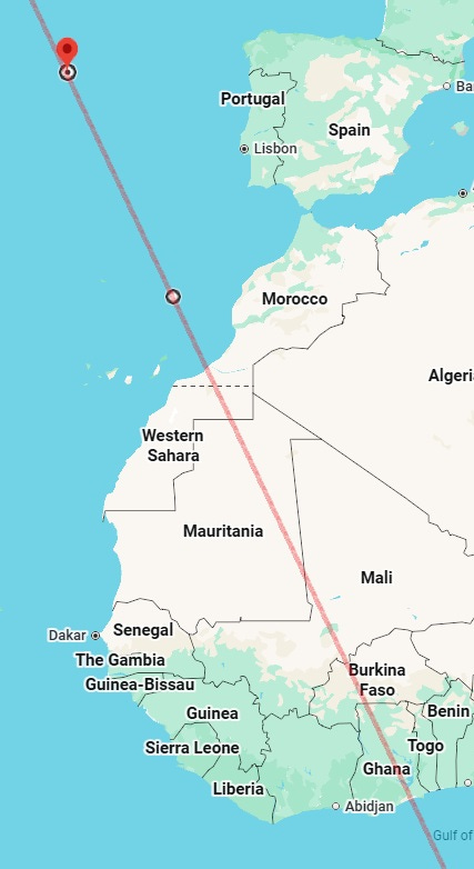
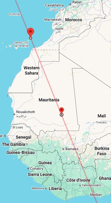
- Line between 29°21′N, 13°19′W (off Órzola, Canary Islands, Spain) and 18°00′N, 8°16′W (near Tiourébougou, Hodh El Chargi, Mauritania). Noteworthy accidents and incidents affecting students, the young, mediapersons or travellers also possible near this line. Strong winds also may blow at some places near this line.
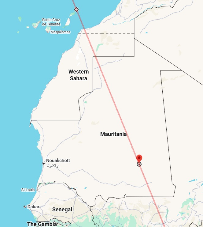
A wider overview of the line is shown below:
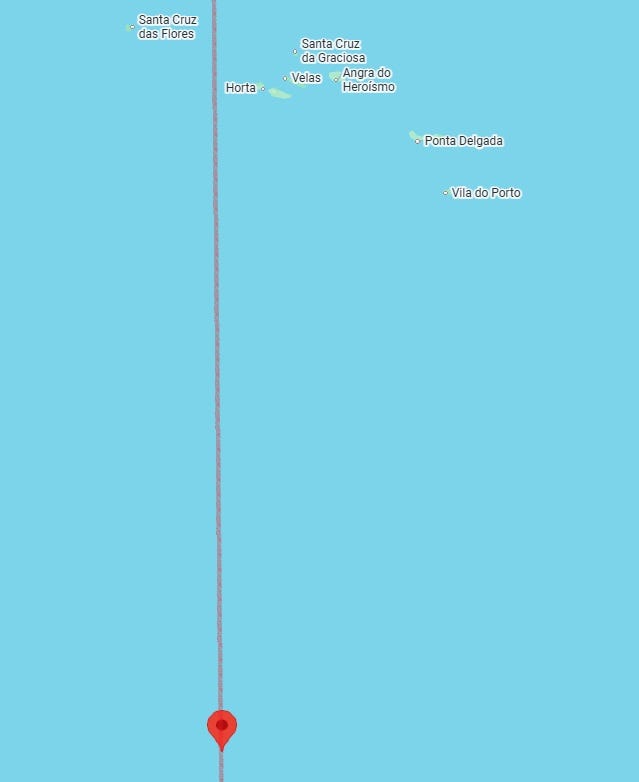
- Straight line running through 28°00′N, 29°25′W (south off Horta, Azores, Portugal). M5.0+ earthquake or heavy rains or strong storm could occur near this line, as can other types of malefic incidents. Ships passing near this line ought to be careful.
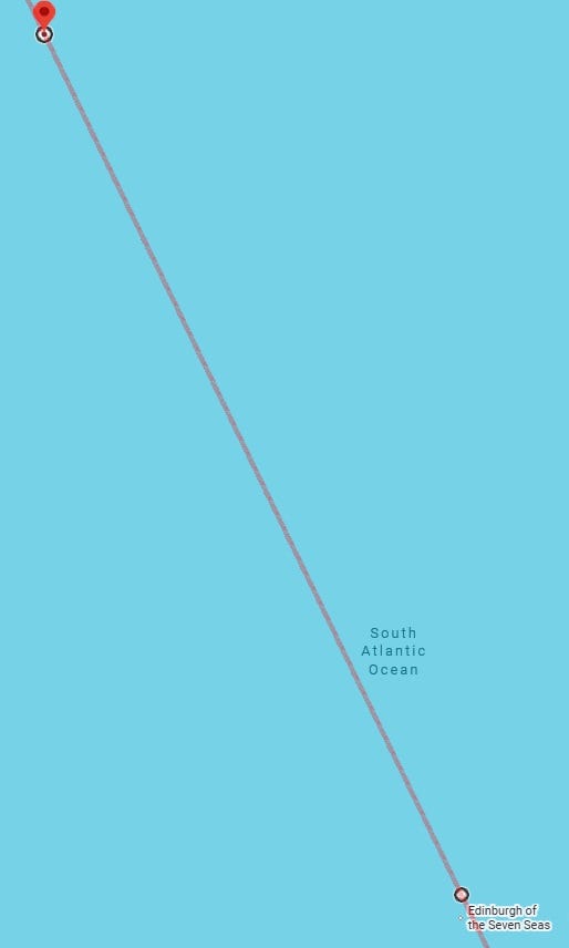
- Line between 7°05′S, 27°48′W (off Brazil) and 36°23′S, 12°16′W (near Edinburgh of the Seven Seas, Tristan da Cunha, Saint Helena, Ascension and Tristan da Cunha, UK). M4.5+ earthquake possible near this line. Strong rains or storm also likely.
- Straight line running through 64°00′N, 34°33′W (off Kulusuk, Sermersooq, Greenland). There may be accidents or other malefic incidents near this line in addition to, or instead of, earthquakes.
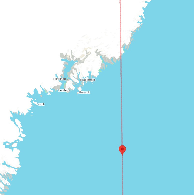
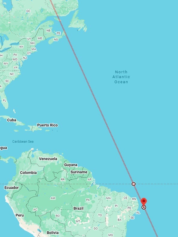
When extended south, the line will pass close by Brazil:
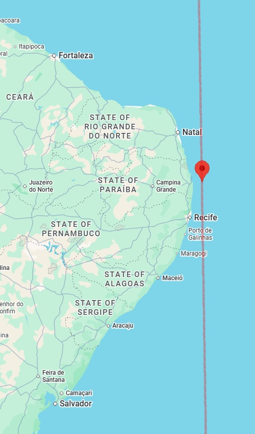
- Straight line running through 0°00′N, 36°06′W (off Macau, Rio Grande do Norte, Brazil). M5.0+ earthquake could occur near this line. Noteworthy accidents, fires, incidents of violence or strong precipitation may also happen near some parts of this line.
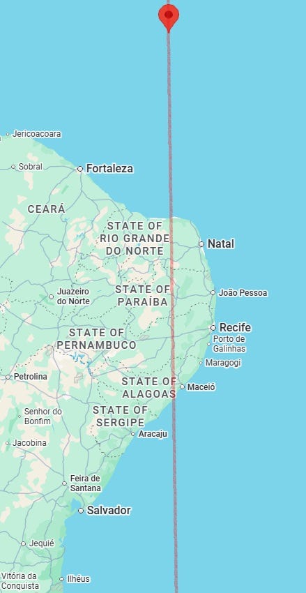
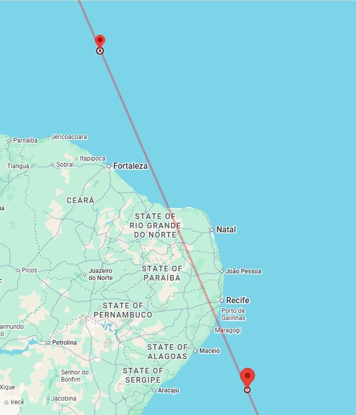
- Line between 0°00′N, 36°33′W (off Fortaleza, Ceará, Brazil) and 8°00′S, 33°04′W (off Recife, Pernambuco, Brazil). Noteworthy accidents, fires, incidents of violence or strong precipitation may happen near some parts of this line.
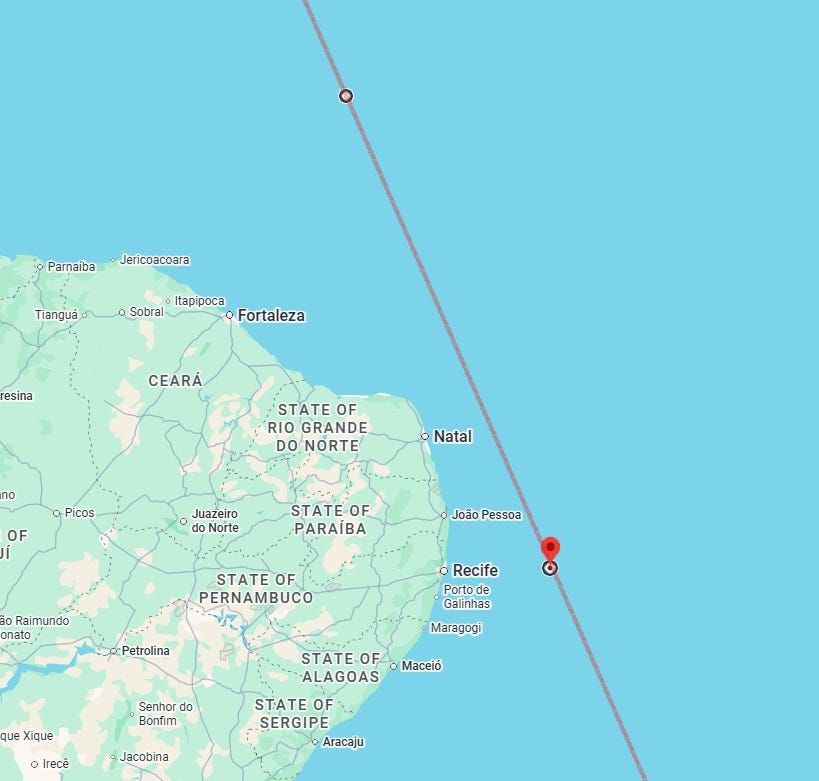
When extended north, the line will hit Canada crossing the Cape Breton Island (Nova Scotia) before going on to Quebec.
- Straight line running through 8°00′S, 38°01′W (near Saquinho, Pernambuco, Brazil). M4.5+ earthquake, bad weather or noteworthy accidents or violent incidents possible near this line or the next line.
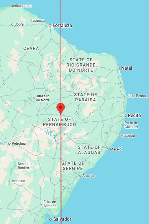
- Line between 0°00′N, 38°49′W (off Trairi, Ceará, Brazil) and 10°54′S, 34°03′W (off Maceió, Alagoas, Brazil). M5.0+ earthquake, bad weather or noteworthy accidents or violent incidents possible near this line or the previous line.
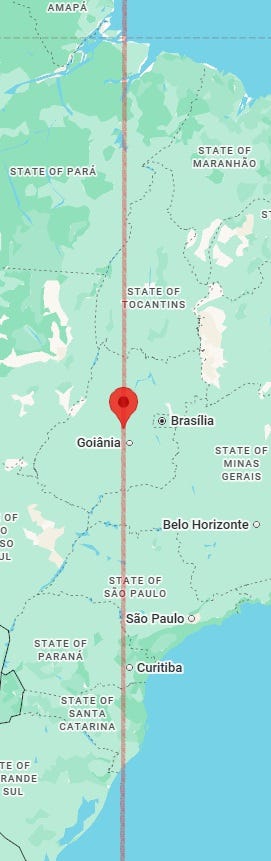
- Straight line running through 15°00′S, 49°19′W (near Santa Isabel, Goiás, Brazil).
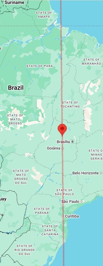
- Straight line running through 16°00′S, 49°30′W (near Santa Rosa de Goiás, Goiás, Brazil). There may be accidents or other malefic incidents near this line in addition to, or instead of, earthquakes. There is some probability of violence, incidents of drug overdose, strange crimes or noteworthy accidents near this line.
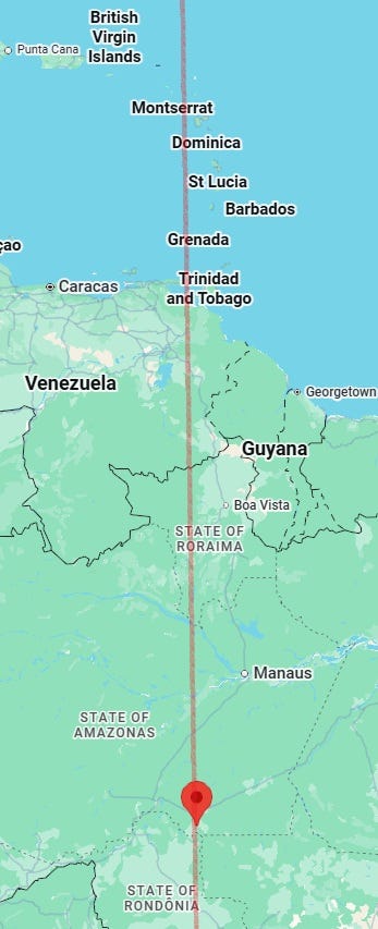
- Straight line running through 8°24′S, 61°43′W (near São Cecília, Amazonas, Brazil). There may also be noteworthy accidents, strong winds and incidents affecting students, the young, mediapersons or travellers near this line.
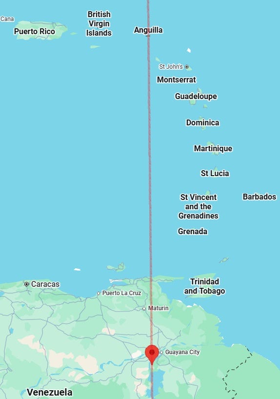
- Straight line running through 8°00′N, 62°57′W (south of La Encrucijada, Bolívar, Venezuela). Accidents, disruption of electricity or telecom networks, troubles to ruling powers and stormy weather also possible near some parts of this line.
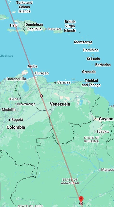
- Line between 8°24′N, 69°05′W (near La Hoyada, Portuguesa, Venezuela) and 8°24′S, 62°53′W (near Demarcação - Porto Velho, Rondônia, Brazil). There may also be noteworthy accidents, strong media controversies and incidents affecting students, the young, mediapersons or travellers near this line.
- Line between 9°00′N, 70°37′W (near Agua de Las Flores, Mérida, Venezuela) and 19°00′S, 60°12′W (near Potrenuma, Departamento de Santa Cruz, Bolivia). There may also be accidents, fires and violent incidents, strong lightning and storms, or communication troubles near parts of this line. There could also be troubles to governing people near some parts of this line.
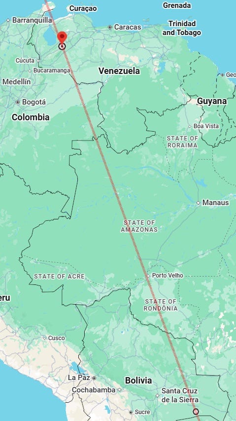
When extended north, the same line can be described thus: between 40°25′N, 85°15′W (near Millgrove, Indiana, USA) and 20°52′N, 75°15′W (off Guajaca Uno, Holguin, Cuba).
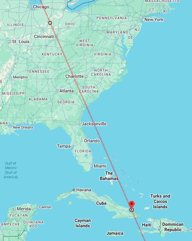
- Line between 38°00′N, 84°21′W (near Lexington, Kentucky, USA) and 30°30′N, 80°17′W (off Jacksonville, Florida, USA).
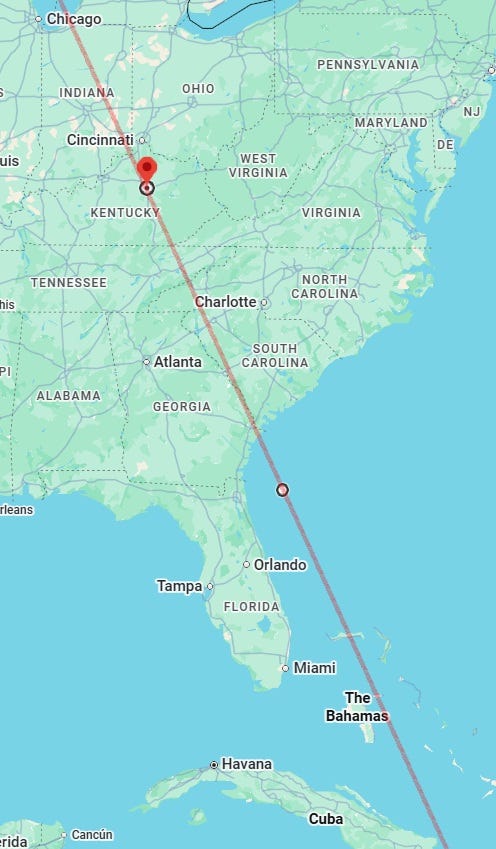
The Kentucky wider area looks vulnerable to some extent, and there could be an M4.5+ earthquake or some other noteworthy malefic incident near this line, especially in the Kentucky wider area. Note that M4.0+ earthquakes in this part of the USA are not common.
- Straight line running through 15°00′N, 89°17′W (near Lajillal, Zacapa, Guatemala).
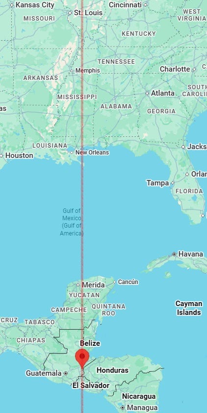
Again, the Kentucky (USA) wider area, as shown below, looks more vulnerable for a potential malefic incident: earthquake, very cold weather, noteworthy transportation accident, violent incident, fire, etc.
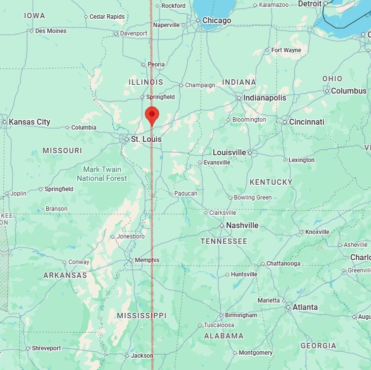
- Straight line running through 36°36′N, 90°05′W (south of Powe, Missouri, USA). Noteworthy accident or other malefic incident or communication disruptions possible near this line. Violent incident, troubles for airplane or other air or water travel, fires or other malefic incident also possible near this line.
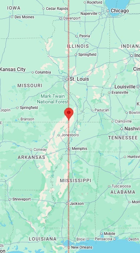
- Straight line running through 42°08′N, 91°26′W (near Stone City, Iowa, USA). Noteworthy accident, terror/shooting incident, or incidents affecting students, the young, mediapersons or travellers may occur near this line. Death of a writer or journalist (or some other media person) could happen near this line. Aviation incidents could also happen near this line.
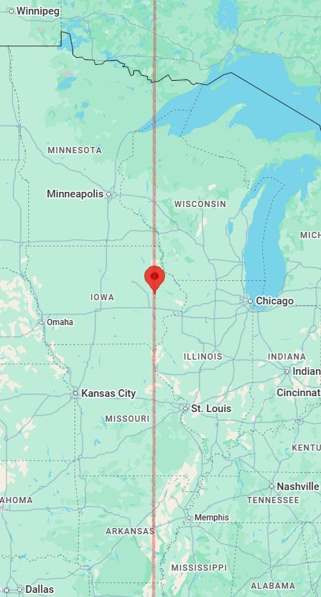
- Straight line running through 22°00′N, 98°10′W (near Santa Anita, Veracruz, Mexico).
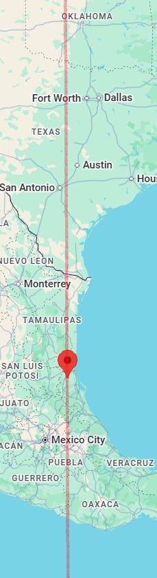
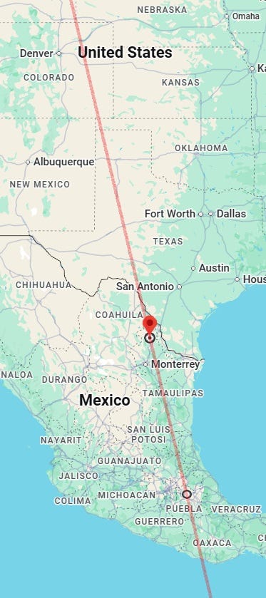
- Line between 27°00′N, 100°05′W (near Nuevo Anáhuac, Nuevo Leon, Mexico) and 19°15′N, 98°05′W (near San José Aztatla, Tlaxcala, Mexico).
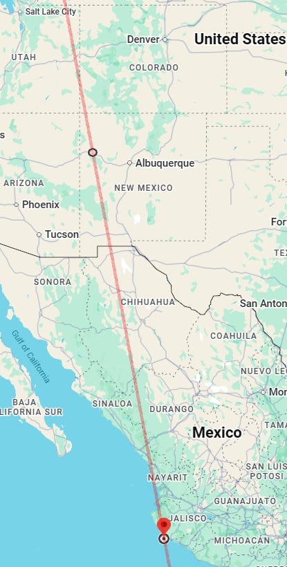
- Line between 35°30′N, 108°26′W (near Iyanbito, New Mexico, USA) and 19°15′N, 105°02′W (off Arroyo Seco, Jalisco, Mexico). Water accidents or controversies over water also possible near this line.
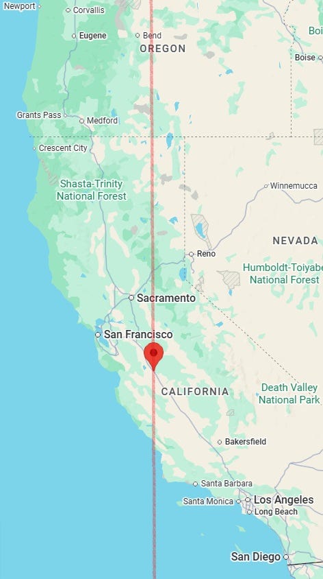
- Straight line running through 37°00′N, 120°52′W (near Los Banos, California, USA). M5.0+ earthquake possible near this line or the next line. Fires, shootings and violent incidents, accidents and other malefic incidents also possible near this line.
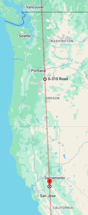
- Line between 45°00′N, 121°17′W (near Simnasho, Oregon, USA) and 38°00′N, 120°52′W (near Milton, California, USA). M5.0+ earthquake possible near this line or the previous line. Fall of structures and other noteworthy violent and malefic incidents may also take place.
- Line between 45°00′N, 124°12′W (off Lincoln City, Oregon, USA) and 36°00′N, 124°17′W (off Monterey, California, USA). Strongly violent incidents, fall of structures, noteworthy accidents and even M6.0+ earthquake possible near this line or the next three lines. Storms also possible near some parts of this line. There could be incidents near this line which lead to mourning for a prominent person or for several people.
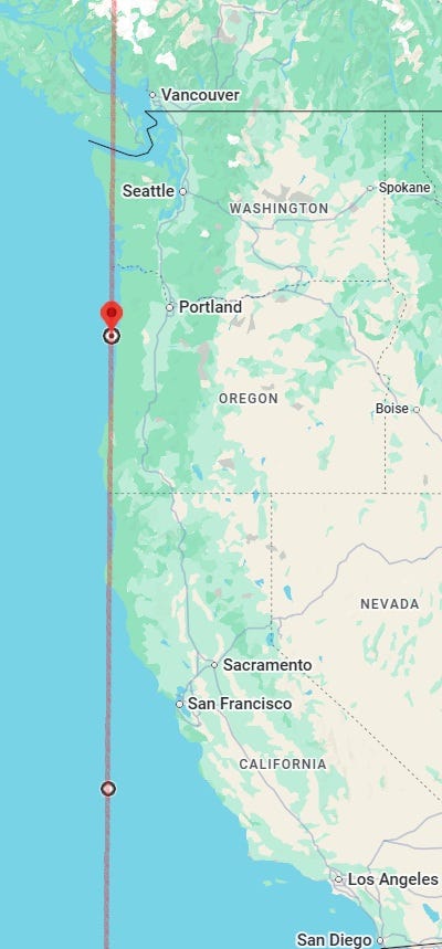
- Line between 54°00′N, 124°41′W (near Lejac, British Columbia, Canada) and 49°00′N, 124°55′W (near Green Cove, British Columbia, Canada). Fires, noteworthy accidents, lightning and storms or bad weather also possible near parts of this line.
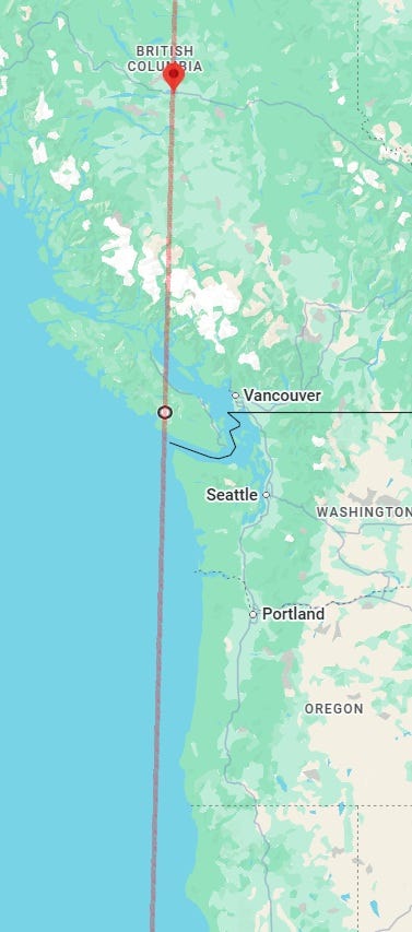
- Line between 54°00′N, 125°27′W (south of Sheraton, British Columbia, Canada) and 50°30′N, 125°45′W (near Jackson Bay, British Columbia, Canada). Noteworthy accidents, fall of structures and other malefic incidents as well as bad weather also possible near this line.
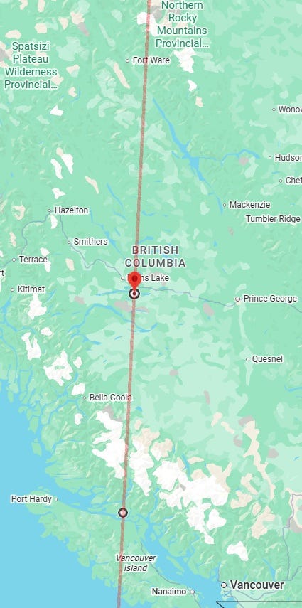
- Straight line running through 50°00′N, 126°33′W (south of Woss, British Columbia, Canada). Fires, noteworthy accidents, other malefic incidents as well as bad weather also possible near parts of this line.
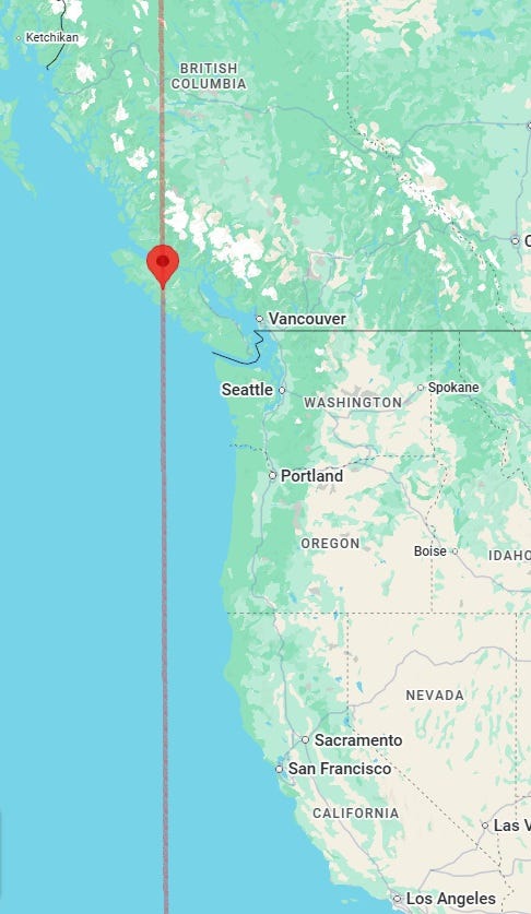
- Line between 59°00′N, 127°31′W (near Chee House, British Columbia, Canada) and 55°00′N, 128°54′W (near Rosswood, British Columbia, Canada). There may be accidents or other malefic incidents near this line in addition to, or instead of, earthquakes.
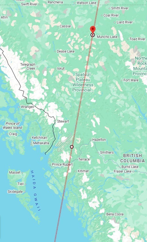
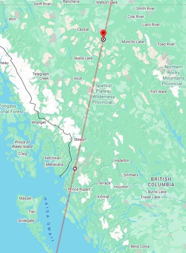
- Line between 59°00′N, 128°11′W (near Sandpile Lakes, British Columbia, Canada) and 55°00′N, 129°48′W (near Sharp Peak, British Columbia, Canada).
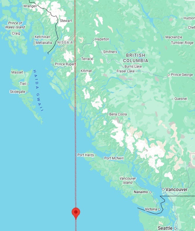
- Straight line running through 48°00′N, 128°49′W (off Vancouver Island, British Columbia, Canada). M5.0+ earthquake possible near this line. Fall of structures, accidents and other malefic incidents as well as strongly cold weather or stormy weather possible near parts of this line.
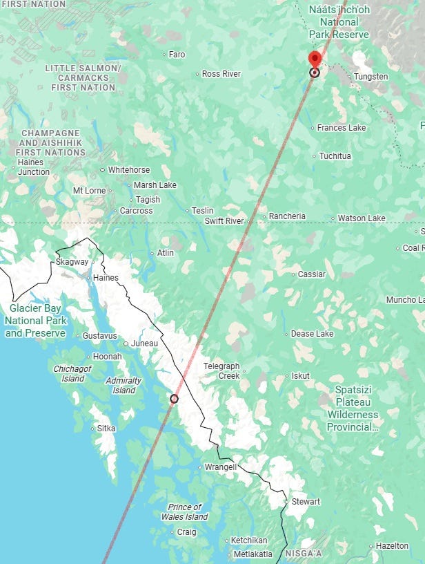
- Line between 62°00′N, 129°13′W (near Shannon Peak, Yukon, Canada) and 57°30′N, 133°05′W (near Hobart Bay, Alaska, USA). Take a 265 km margin on the west of this line instead of the usual 250 km. M5.3+ earthquake possible near this line.
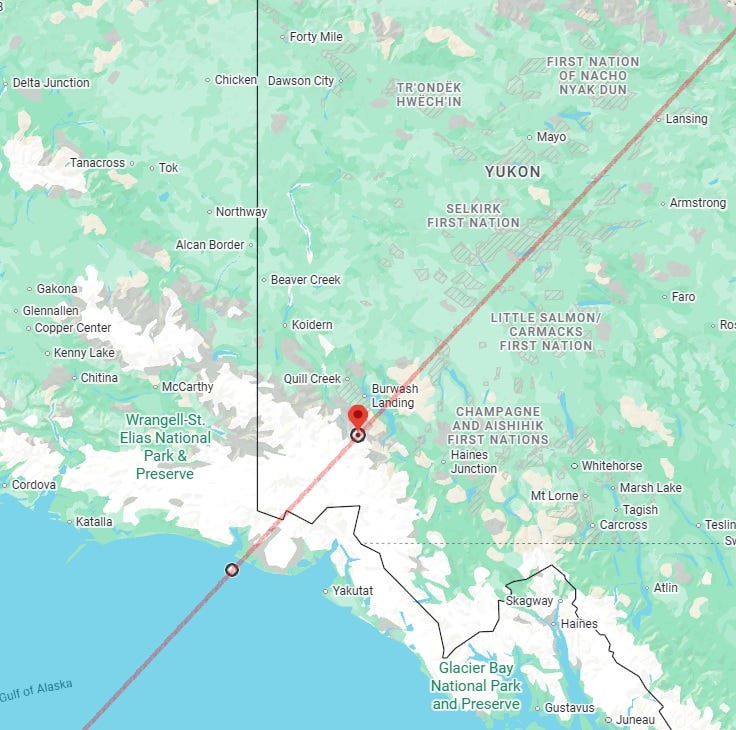
- Line between 61°00′N, 139°07′W (near Bighorn Peak, Yukon, Canada) and 59°45′N, 141°29′W (off Icy Bay, Alaska, USA). Take a 300 km margin on the west/left/upper side of this line instead of the usual 250 km. Copious precipitation also possible near this line during this period.
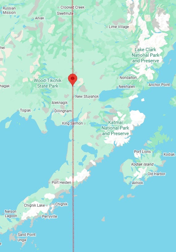
- Straight line running through 59°45′N, 157°20′W (near Koliganek, Alaska, USA). Take a 265 km margin on the west of this line instead of the usual 250 km. M5.0+ earthquake possible near this line.
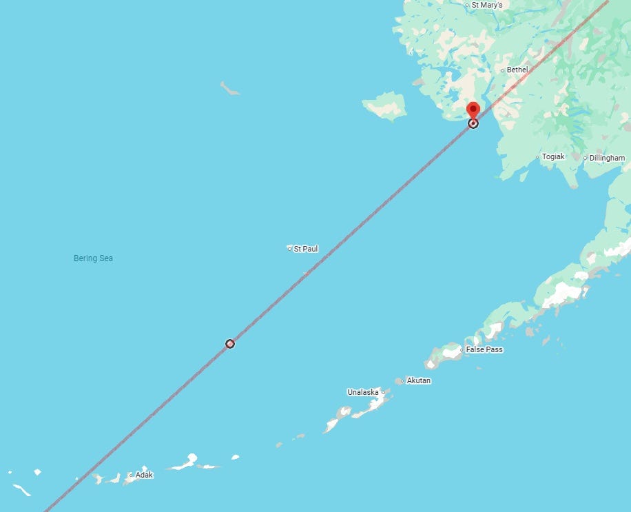
- Line between 59°45′N, 162°56′W (off Kwigillingok, Alaska, USA) and 55°00′N, 172°40′W (north of Seguam Island, Alaska, USA).
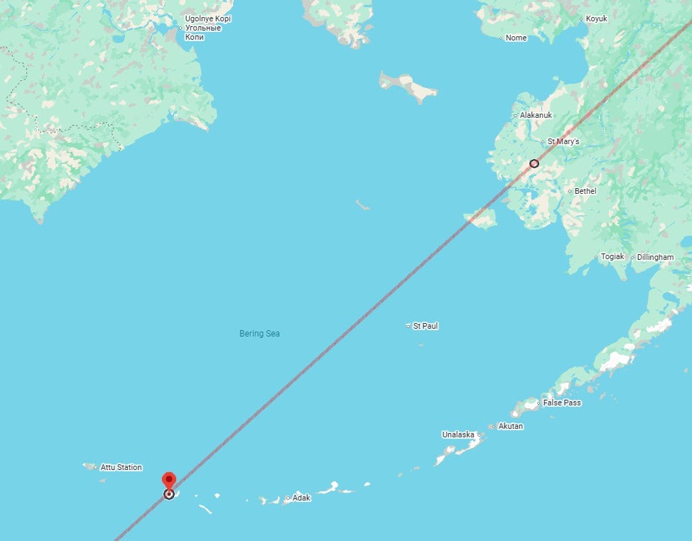
- Line between 61°30′N, 163°39′W (near Kgun Lake, Alaska, USA) and 52°00′N, 177°05′E (near Kiska Island, Alaska, USA).
Part I, with predictions for the Eastern Hemisphere, for the period of 10 to 21 December 2025, was published earlier, here.
Note 1: Owing to lack of time, I am unable to look at every single prediction line in detail. I am publishing only those which look more prominent to me. It is possible that it may lead me to miss publishing some lines near which a strong enough earthquake may take place, but I can only do my best with the time constraints possible. However, wherever a line is given, an earthquake or some other incident that can or does lead to fall of structures is highly likely to happen near it, unless weak probability is already noted.
Note 2: Sometimes, earthquake indications on the chart may be rather about other forms of earth disturbances such as volcanic activity, rockfall, avalanche, mudflow, landslide or ground subsidence. They could also be about “non-natural” forms of falls of structures: for example, the collapse of a bridge, an industrial accident in which a big piece of equipment falls down, a plane crash, or a building or mine collapse. Astrologically, they are all one category. So when I say earthquake, the complete category is meant. Please always bear this in mind.
Note 3: If a big earthquake has happened in a place, aftershocks may continue for days, weeks and even months. I predict the big (the first) earthquake, not always the aftershocks (unless they are also seen prominently on the charts, as does happen sometimes).
Disclaimer: The predictions or interpretations provided on this website or in this newsletter for any weather or earthquake or for anything else are for entertainment purpose only. Nothing is guaranteed to happen. Services offered by Palmist Ankur or any content published by Palmist Ankur are NOT a recommendation or solicitation to buy or sell any securities, bonds or any other financial instruments. While the information that Palmist Ankur provides you is with aims to serve as a guide, it does not replace professional advice. By subscribing to the content of this website or purchasing any other type of service, you fully agree and understand this and waive Palmist Ankur off any responsibility and liability from this event and its outcome.
Two students shot in Frankfort, Kentucky. https://www.cnn.com/2025/12/09/us/kentucky-state-university-frankfort-shooting